Pagasae

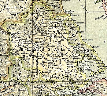
Pagasae or Pagases (Greek: Παγασαί, romanized: Pagasaí),[1] also Pagasa,[2] was a town and polis (city-state)[3] of Magnesia in ancient Thessaly, currently a suburb of Volos. It is situated at the northern extremity of the bay named after it (Παγασητικὸς κόλπος, or Latin: Pagasaeus Sinus).[4][5][2][6]
Pagasae is celebrated in mythology as the port where Jason built the ship Argo, and from which he sailed upon his adventurous voyage: hence some of the ancients derived its name from the construction of that vessel, (from πήγνυμι), but others from the numerous and abundant springs which were found at this spot.[7] Apollonius of Rhodes describes the setting vividly in the first book of his Argonautica.[8] Pagasae was conquered by Philip II of Macedon after the defeat of Onomarchus; in Diodorus's report the place is spelt Παγαί - Pagaí.[9][10] On the foundation of Demetrias in 290 or 293 BCE, Pagasae was one of the towns whose inhabitants were transferred to the new city; but after the Roman conquest Pagasae was restored, and again became an important place. In the time of Strabo it was the port of Pherae, which was the principal city in this part of Thessaly. Pagasae was 90 stadia from Pherae, and 20 from Iolcos.[7]
As of the nineteenth century, the ruins of the ancient city were to be seen near Volos, which has given the modern name to the bay. The acropolis occupied the summit of some rocky heights above Cape Angkístri, and at the foot of the rocks are many copious sources of water, of which Strabo speaks. But as these springs are rather saline to the taste, the city was provided in the Roman times with water from a distance by means of an aqueduct, the ruined piers of which are still a conspicuous object.[11] The accepted site is in the modern village of Nees Pagasees in the municipality of Volos;[12] however, the most recent excavations seem to indicate that Pagasae may be the ruins at nearby Soros, also in the municipality of Volos.[3][13]
See also
[edit]References
[edit]- ^ Pliny. Naturalis Historia. Vol. 4.8.15.
- ^ a b Pomponius Mela. De situ orbis. Vol. 2.3.6.
- ^ a b Mogens Herman Hansen & Thomas Heine Nielsen (2004). "Thessaly and Adjacent Regions". An inventory of archaic and classical poleis. New York: Oxford University Press. pp. 699–700. ISBN 0-19-814099-1.
- ^ Scylax, p. 24.
- ^ Strabo. Geographica. Vol. ix. p.438. Page numbers refer to those of Isaac Casaubon's edition.
- ^ David Sacks, Encyclopedia of the Ancient Greek World, rev. ed. by Lisa R. Brody (Facts on File, 2005), pp. 140, 347.
- ^ a b Strabo. Geographica. Vol. ix. p.436. Page numbers refer to those of Isaac Casaubon's edition.
- ^ James J. Clauss, The Best of the Argonauts: The Redefinition of the Epic Hero in Book One of Apollonius' Argonautica (University of California Press, 1993), p. 88ff.
- ^ Dem. Ol. i. pp. 11, 13; Diodorus Siculus. Bibliotheca historica (Historical Library). Vol. 16.31.
- ^ James R. Ashley, The Macedonian Empire: The Era of Warfare under Philip II and Alexander the Great, 359–323 B.C. (MacFarland, 1998), p. 120, 124–125, 132–133, 361.
- ^ William Martin Leake, Northern Greece, vol. iv. p. 368, et seq.
- ^ Richard Talbert, ed. (2000). Barrington Atlas of the Greek and Roman World. Princeton University Press. p. 55, and directory notes accompanying. ISBN 978-0-691-03169-9.
- ^ Lund University. Digital Atlas of the Roman Empire.
![]() This article incorporates text from a publication now in the public domain: Smith, William, ed. (1854–1857). "Pagasae". Dictionary of Greek and Roman Geography. London: John Murray.
This article incorporates text from a publication now in the public domain: Smith, William, ed. (1854–1857). "Pagasae". Dictionary of Greek and Roman Geography. London: John Murray.
39°18′47″N 22°55′51″E / 39.312923°N 22.930713°E
