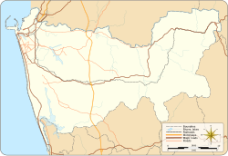
Nugegoda
Appearance
Nugegoda
නුගේගොඩ நுகேகொடை | |
|---|---|
Nugegoda town | |
| Coordinates: 6°51′50″N 79°53′56″E / 6.86389°N 79.89889°E | |
| Country | Sri Lanka |
| Province | Western Province |
| District | Colombo District |
| Time zone | UTC+5:30 (Sri Lanka Standard Time Zone) |
| Postal Code | 10250[1] |
Nugegoda (Sinhala: නුගේගොඩ) is a large, densely populated suburb of Colombo, Sri Lanka. It is located in the border of Sri Jayawardenapura Municipal Council limits and Dehiwela Mt. Lavinia Municipal Council limits, just outside Colombo city limits. It has a population of roughly over 250,000 people.[2]
Education
[edit]Schools in the region include:
- Open University of Sri Lanka Nawala
- Anula Vidyalaya
- Lyceum International School
- Royal Institute International School
- Samudradevi Balika Vidyalaya
- St. John's College, Nugegoda
- St. Joseph's Boys' College, Nugegoda
- Sujatha Vidyalaya
Communal Transportation
[edit]Railway
The city of Nugegoda has three Railway Stations located within its boundaries.
- Nugegoda Railway Station located in the heart of the city, just beside the Main Bus Stand and the shopping complex.
- Pangiriwatte Railway Station located near the Delkanda Junction on the Old Kesbewa road.
- Udahamulla Railway Station located on the Nugegoda - Hokandara road (Route 689), close to the Udahamulla Junction.
Buses
Since Nugegoda is located between Colombo Metropolitan area and other outskirt cities it has Bus routes plying to both.
Bus routes which operate through Nugegoda.
- 112 - Maharagama - Kotahena (via Bambalapitiya, Colpetty & Fort)
- 118 - Dehiwala - Beddagana (via Dehiwala Zoo, Kalubowila & Jubilee Post)
- 122 - Avissawella - Pettah
- 125 - Ingiriya/Padukka - Colombo
- 131 - Maharagama - Wellampitiya (via Havelock, Narahenpita, Borella, Dematagoda & Kolonnawa)
- 138 - Homagama/Kottawa/Maharagama - Pettah
- 138/2 - Mattegoda - Pettah
- 138/3 - Rukmalgama - Pettah
- 138/4 - Athurugiriya - Pettah
- 138/5 - Mullegama - Pettah (via Godagama & Homagama)
- 138/280 - Diyagama - Pettah (via Kottawa & Dolekade Junction)
- 163 - Dehiwala - Battaramulla (via Pagoda & Kotte)
- 176 - Dehiwala/Karagampitiya - Hettiyawatta (via Dehiwala Zoo)
- 313 - Homagama - Kalubowila (via Kottawa Maharagama & Kohuwala)
Bus routes which terminate at Nugegoda.
- 115 - Pettah (via Jawatte & Torrington)
- 117 - Ratmalana Railway station (via Gamsaba Junction, Pepiliyana, Attidiya & Maliban Junction)
- 119 - Maharagama (via Jubilee Post, Embuldeniya & Old Kottawa road)
- 156 - Dehiwala (via Kohuwala, Anderson road & Nedimala Junction)
- 168 - Kotahena (via Jubilee Post, Kotte, Rajagiriya, Borella, Slave Island, Fort)
- 173 - Thotalanga (via Nawala & Narahenpita)
- 176 - Hettiyawatta (via Nawala, Rajagiriya, Borella & Armour Street)
- 183 - Panadura (via Kalubowila, Dehiwala & Moratuwa)
- 212/341 - Bokundara (via Maharagama, Pannipitiya, Erawwala & Makuludoowa)
- 259 - Thalapathpitiya (via Jubilee Post)
- 689 - Hokandara/Pittugala (via Udahamulla Railway, Madiwela & Thalawathugoda)
- 690 - Jayawardenepura Hospital (via Jubilee Post, Embuldeniya, Madiwela & Kimbulawala Junction)
- 992 - Athurugiriya (via Maharagama & Pannipitiya)
Long distance bus services which operate through Nugegoda
- 17 - Panadura - Kandy
- 99 - Badulla /Welimada /Passara/Lunugala - Colombo
- 122 - Kataragama/Hambantota/Embilipitiya/Ratnapura - Colombo
References
[edit]- ^ "Postal Code of Nugegoda (Post Office) :: Mohanjith". mohanjith.net. Archived from the original on 2008-10-29.
- ^ "Where is Nugegoda, Colombo, Sri Lanka on Map Lat Long Coordinates". www.latlong.net. Retrieved 2023-02-28.


